
Reality Capture & Spatial Mapping Partner
Supporting surveying, engineering, agriculture and infrastructure organisations with high-accuracy spatial data, scalable delivery capability and low-risk integration


Spatial Technologies Pty Ltd is an Australian specialist spatial services firm delivering reality capture, UAV operations, LiDAR and geospatial data solutions for projects where accuracy, repeatability and operational reliability are critical.
We support organisations requiring specialist capture capability, surge delivery capacity or integrated spatial workflows across construction, infrastructure, agriculture, environmental and asset management sectors.
Our services combine UAV photogrammetry, LiDAR, mobile SLAM scanning, spatial processing and technical advisory to deliver reliable, repeatable datasets suitable for survey, engineering, asset management and digital twin workflows.

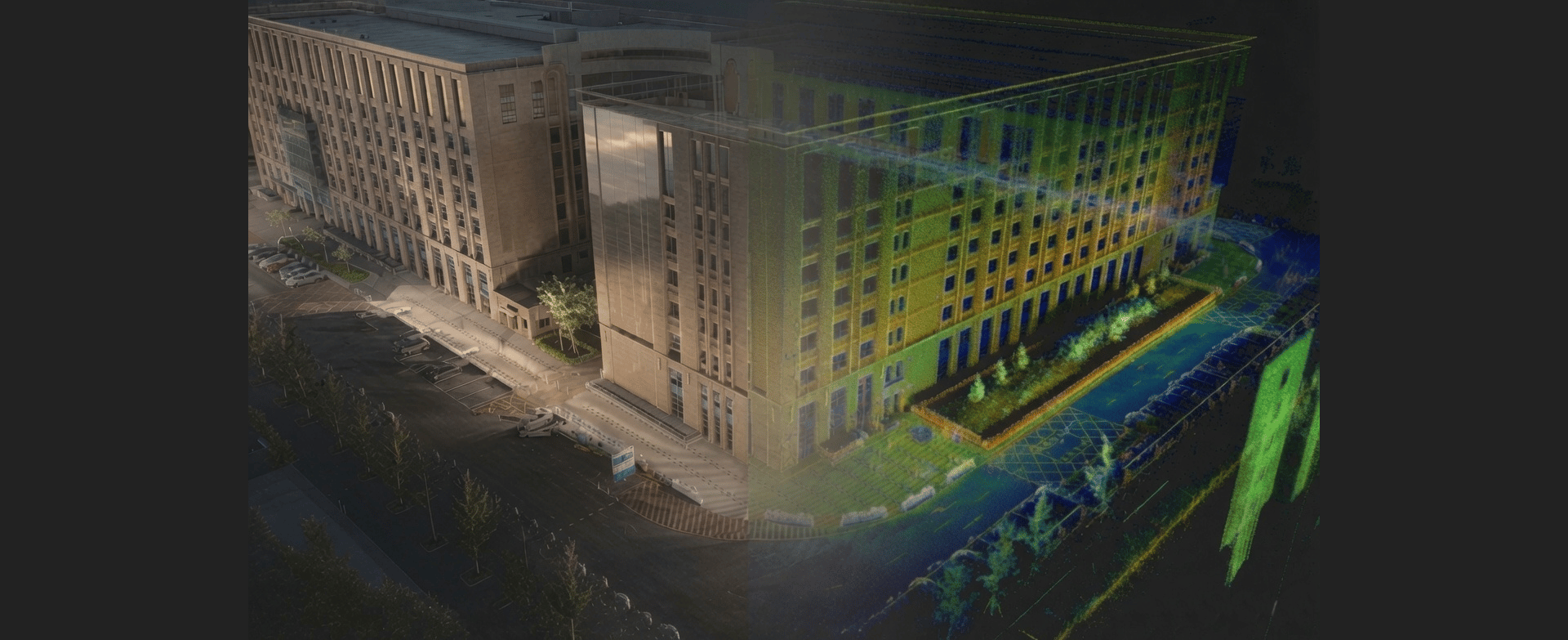
Reality Capture
High-accuracy UAV, LiDAR and SLAM capture workflows for construction, infrastructure and environmental projects.
Spatial Data Processing
Point cloud optimisation, orthomosaics, terrain generation, QA validation and GIS-ready deliverables.
Technical Advisory
Workflow integration, Pix4D training, capture methodology and operational support.
Quality & Compliance
CASA-compliant UAV operations (CASA.ReOC.0156)
Documented capture and processing workflows
Repeatable and auditable processing pipelines
Validation against project accuracy requirements
Insured professional services
Project-specific SWMS and risk controls
Technologies & Platforms
DJI Enterprise
Pix4D
LiDAR
SLAM
GIS
Digital Twins
Cloud Spatial Workflows
Why Organisations Engage Us
Specialist capability without permanent overhead
Rapid mobilisation for complex spatial capture
Seamless integration with internal teams
Reduced delivery and reputational risk
Practical field and processing expertise
Clear communication and dependable outcomes
Tell us your site type, operational challenge, and timeline. We respond within one business day with a deployment assessment.
The data works the day it arrives on site.
Pages
Get in touch
info@spatialtechnologies.com.au
Based in Australia — deployments across Asia-Pacific
Response within one business day
(C) 2026 Spatial Technologies Pty Ltd - Specialist spatial data capture and reality modelling solutions.